
A588 Lancaster to Skippool: Collision Risks and Areas Requiring Extra Care
The A588 between Lancaster and Skippool is an important connection for villages along the Fylde coast. Yet its combination of rural bends, changing speed limits, narrow sections and busy junctions makes it a route where drivers must remain especially alert.
The road was selected as one of Lancashire’s five historically highest-risk A-roads under the government-backed Safer Roads Fund programme. Lancashire County Council allocated £1.9 million to safety improvements between Pointer Roundabout and Skippool, including average-speed cameras across approximately 26 kilometres, clearer centre and edge markings, and measures for cyclists at Pointer Roundabout.
Where are the more dangerous areas?
Pointer Roundabout and the Lancaster approach
At the northern end of the route, Pointer Roundabout brings together the A588, the A6 and local traffic near Lancaster.
The mixture of circulating vehicles, turning movements, pedestrians and cyclists creates potential conflict. Lancashire County Council has proposed improved crossings, off-road cycle routes, clearer signs, raised crossing points and resurfacing. Construction is expected to begin during 2026.
Drivers should approach at a controlled speed, check carefully for cyclists and avoid changing lanes at the last moment.
The rural section around Cockerham
Between Lancaster and Cockerham, the A588 becomes an exposed rural road with bends, junctions and long stretches that can encourage excessive speed.
The apparent openness of the landscape can be deceptive. Visibility may deteriorate quickly around bends, while rain, standing water, darkness and glare can make road edges harder to judge. Agricultural vehicles, cyclists and traffic emerging from minor roads add to the risk.
A safe following distance is particularly important here. Drivers should resist treating the speed limit as a target when visibility or road conditions are poor.
Head Dyke Lane and the Pilling area
Around Pilling, the route contains narrow sections with restricted forward visibility and limited pedestrian facilities. Local roads, property accesses and agricultural traffic introduce frequent turning movements.
Lancashire County Council’s highways evidence identifies sections where the carriageway has largely unbound edges, narrow verges and signs of vehicles overrunning the roadside. These conditions can be especially hazardous when large vehicles meet on a bend.
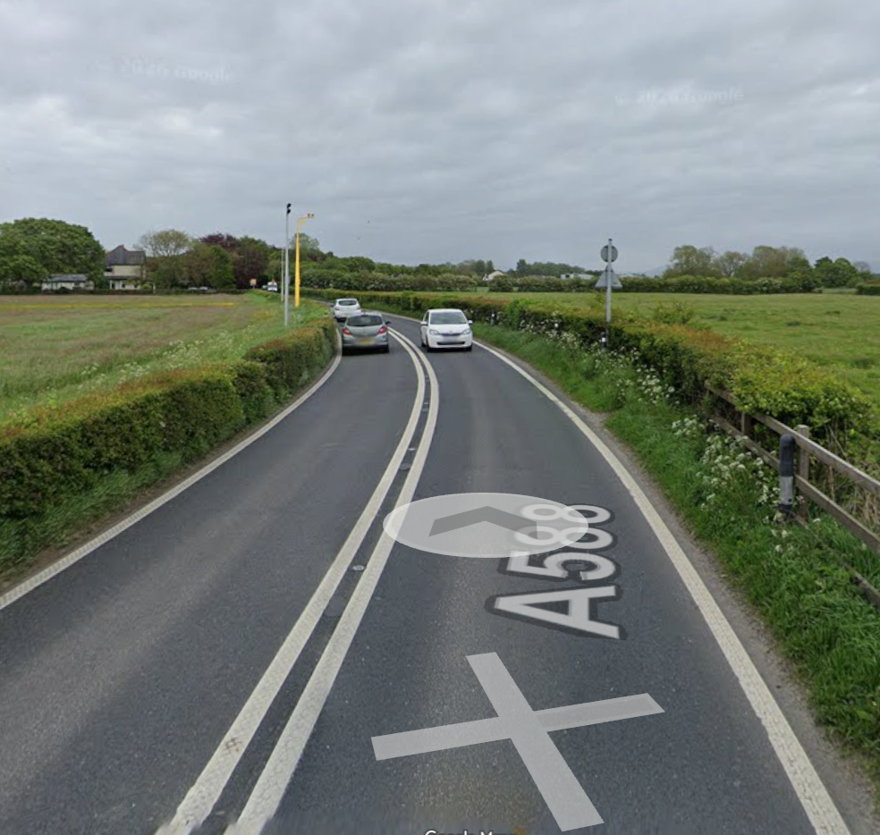
Fold House Farm bend
The bend near the access to Fold House Farm has been specifically identified as constrained.
Council evidence states that the road may be too narrow for an HGV or bus and another vehicle to pass comfortably at the same time. Restricted visibility can leave approaching drivers with little time to respond, while verge damage indicates that vehicles sometimes leave the carriageway edge to negotiate the bend.
Drivers should slow before entering the bend and be prepared to stop for an oncoming large vehicle.
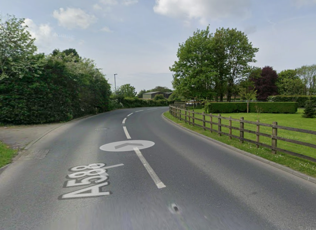
Burned House Lane, Park Lane and Cemetery Lane junction
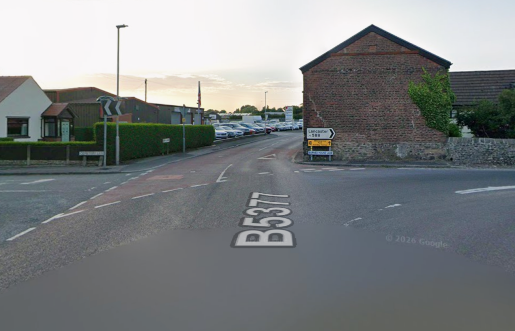
The junction where the A588 Burned House Lane meets the B5377 Park Lane and Cemetery Lane is one of the route’s clearest areas of concern.
The road turns through a sharp bend, with buildings restricting the view ahead. Large vehicles may need to cross towards the opposing lane to negotiate it. Lancashire County Council reported four personal-injury collisions in the surrounding location during the five-year period examined in its 2025 highways evidence. Two involved HGVs, including a March 2023 collision involving an HGV and a pedestrian.
This figure relates to the specific area and study period—not the entire A588—but it highlights the need for particular care. Drivers should expect oncoming vehicles near the centre of the road and watch for pedestrians where there is little separation from traffic.
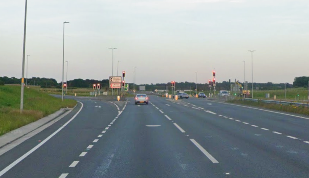
Skippool and the A585 junction
At the southern end, vehicles move between the rural A588 and the faster, busier A585 corridor. Changes in traffic speed, merging vehicles and turning queues can increase the likelihood of rear-end or turning collisions.
Drivers should check their speed early, maintain sufficient space and avoid overtaking as they approach the junction.
The broader collision pattern
The hazards along the A588 are interconnected:
1. Speed can magnify the consequences of mistakes.
2. Tight bends and vegetation can restrict forward visibility.
3. Narrow carriageway sections create conflict between large vehicles.
4. Numerous side roads and accesses generate unexpected turns.
5. Limited footways leave pedestrians, cyclists and equestrians exposed.
6. Wet, dark or windy conditions make the rural sections less forgiving.
Average-speed enforcement is intended to create steadier traffic flow rather than simply make drivers brake at individual camera locations. Lancashire County Council says comparable camera routes in the county recorded collision reductions of up to 86% in an initial evaluation, although that figure should not be interpreted as a measured reduction specific to the A588.
A safer journey depends on consistent caution
The A588 should not be portrayed as uniformly dangerous, and a collision history does not mean an incident is inevitable. However, official investment and highways assessments show that this route contains genuine, recognised risks.
The safest approach is simple: respect the speed limits, reduce speed further when visibility is limited, leave room for large vehicles, expect vulnerable road users and avoid overtaking unless the road ahead is unquestionably clear.